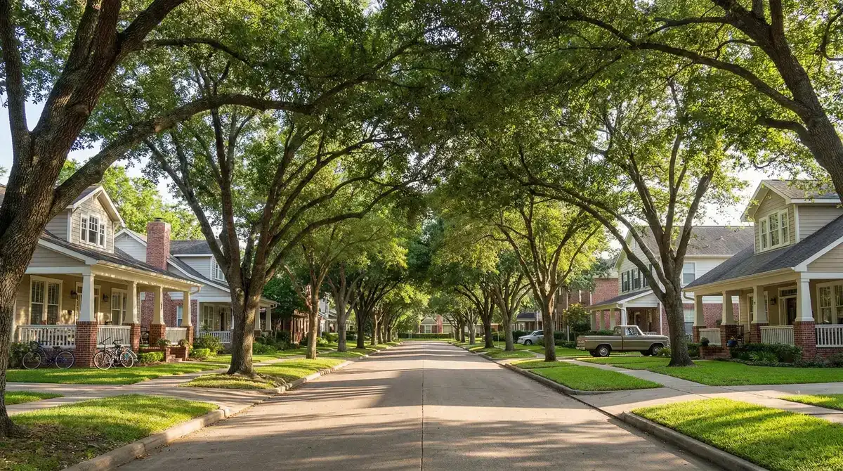
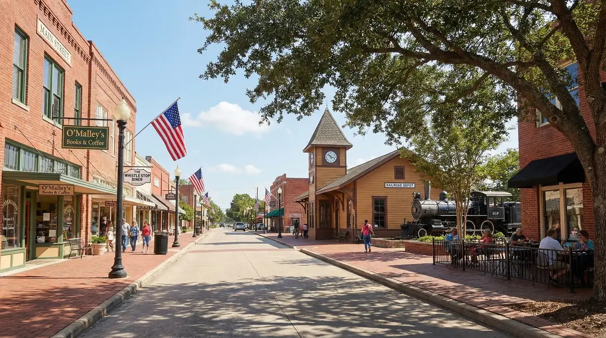
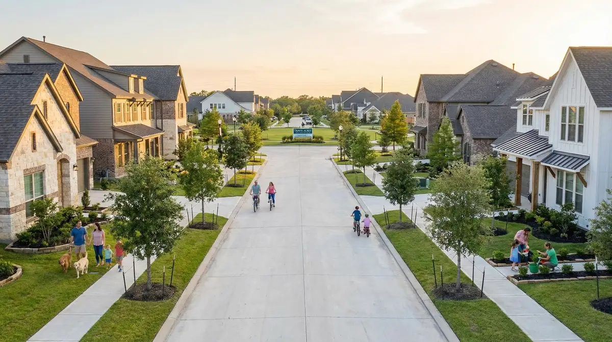
The 25 Best Neighborhoods in Houston (2026 Data Guide)
Updated August 8, 2026·Data: HAR, FEMA, HPD, Harris CAD, TEA·Reviewed by RelocateMeTX Editorial Team
The best neighborhoods in Houston depend on what you are optimizing for. For families, Katy (Katy ISD, TEA B, 88/100), Sugar Land (Fort Bend ISD B), and The Woodlands (Conroe ISD B) lead on schools. The best Houston neighborhoods for apartments are Montrose (Walk Score 87, 1BR around $1,650), Midtown (Walk Score 86, METRORail, 1BR around $1,800), and EaDo (1BR around $1,650); with metro vacancy at 11.6%, landlords across most submarkets are offering 6-8 weeks of free rent. The safest neighborhoods in Houston by violent-crime rate are Friendswood (0.6 per 1,000), The Woodlands (0.7), West University Place (0.8), and Sugar Land (0.9); Friendswood, West U, and Sugar Land each run independent police departments. Below, all 25 areas are compared on flood risk, schools, crime, commute, and total tax cost.
What Are the Best Neighborhoods in Houston in 2026?
The best Houston neighborhoods for relocating families, professionals, and retirees in 2026 depend on your priorities: safety, schools, flood risk, commute, and cost. Based on our analysis of 25 neighborhoods:
Neighborhood
Best For
Median Price
School District (TEA)
Flood Risk
The Heights
Young Families, Character Homes
$695K
Houston ISD (B)
Low (Zone X)
Montrose
Walkability, LGBTQ+, Arts
$675K
Houston ISD (B)
Low (Zone X)
West University Place
Safety, TMC Access, Top Schools
$1.65M
Houston ISD (B)
Low (elevated terrain)
Katy
Families, Top Schools, New Homes
$415K
Katy ISD (B, 88/100)
Low–Moderate (varies by subdivision)
Sugar Land
Families, Safety, Diversity
$460K
Fort Bend ISD (B, 80/100)
Low (levee-protected)
Friendswood
Safety, Schools, Quiet Suburb
$420K
Friendswood ISD (A)
Moderate (Clear Creek corridors)
Pearland
Value, TMC Commute, Growth
$375K
Pearland ISD (A)
Moderate (varies by zone)
The Woodlands
Master-Planned, Families, Nature
$580K
Conroe ISD (B, 85/100)
Variable by village (Spring Creek)
Verified August 2026 · Sources: HAR, FEMA MAAPnext, TEA, HPD
Which Houston Neighborhoods Have the Lowest Flood Risk?
The Heights, Montrose, West University Place, Garden Oaks, and Sugar Land (levee-protected) carry the lowest flood risk in the Houston metro, all classified as FEMA Zone X with minimal Harvey impact. FEMA's draft MAAPnext remapping project would expand Houston's 100-year floodplain designation from approximately 150,000 acres to 200,000 acres; once the maps take effect, some currently Zone X properties will shift into Zone AE. If flood risk is your primary concern, prioritize elevated inner-loop neighborhoods or well-engineered master-planned communities like The Woodlands. Always order an elevation certificate before making an offer on any Houston property.
Which Houston Neighborhoods Have the Best Schools?
Houston's top-rated school districts are in the suburbs: Friendswood ISD (TEA A), Katy ISD (B, 88/100), Tomball ISD (A), Pearland ISD (A), and Fort Bend ISD (B, 80/100) consistently rank among the best in Texas. Note that Houston ISD (HISD) remains under Texas Education Agency state management; the TEA takeover was extended through June 2027, during which time HISD's campus-by-campus quality varies significantly. Families seeking consistently rated schools should look to suburban ISDs rather than HISD-zoned properties.
What Are MUD Taxes and How Do They Affect Houston Home Costs?
Municipal Utility Districts (MUDs) are special taxing jurisdictions that fund water, sewer, drainage, and roads in Houston's unincorporated suburbs. MUD taxes are levied on top of your county, city, and school district taxes, adding $0.20 to $1.50+ per $100 of assessed value in newer communities. On a $400,000 home, MUD tax can add $800–$6,000+ annually. Communities like Katy, Sugar Land (some areas), Pearland, and The Woodlands have MUD districts. Always request the combined property tax rate for your specific address, not just the county average. MUD tax rates typically decline over 10–20 years as district bonds are paid off.
Best Houston Neighborhoods for Families and Top Schools
TrendingDown
11.6%
Apartment Vacancy Rate (20-year high)
💲
$1,200
Median 1BR Rent (metro-wide)
🏠
$330K
Median Home Price (metro-wide)
Percent
2.1-3.5%
Property Tax Range
Houston's 2026 rental market is the most tenant-friendly in two decades. A construction boom that delivered 50,000+ new apartment units since 2023 has pushed vacancy rates to 11.6%, meaning landlords are offering 6-8 weeks of free rent, waived application fees, and reduced deposits across every submarket. If you are relocating to Houston in 2026, you have exceptional leverage to negotiate. Start with our Houston housing guide and moving checklist. Home prices have stabilized after a post-pandemic surge, with median values at $330K metro-wide (HAR March 2026). Inner-loop neighborhoods command significant premiums ($280-$565/sqft) while suburbs offer $135-$220/sqft.
Best Houston Neighborhoods for Young Professionals
Houston is the fourth-largest city in the United States (2.3 million residents, per the U.S. Census Bureau) and the anchor of the fifth-largest metro area (7.9 million). It spans more than 640 square miles — larger than the five boroughs of New York City combined — making your neighborhood choice the single most consequential decision of your relocation.
Houston is the only major American city with no formal zoning code. Instead, development is guided by deed restrictions, lot-size minimums, and market forces. The result is a city where a townhome complex can sit next to a restaurant, which sits next to a warehouse. This creates extraordinary variety but also means you cannot assume anything about your surroundings based on a map; you must visit in person.
The Three-Ring Framework
Greater Houston is organized around two concentric highway loops that define lifestyle, commute, and cost:
Inside the Loop (I-610): The urban core. Walkable neighborhoods (Montrose, Midtown, the Heights), cultural institutions (Museum District), and the shortest commutes to Downtown, TMC, and the Galleria. All schools fall under Houston ISD. No MUD taxes. Most neighborhoods in Zone X (low flood risk).
Between the Loops (I-610 to Beltway 8): The mid-ring. Neighborhoods like Memorial and Bellaire straddle the urban-suburban divide with larger lots. Access to Spring Branch ISD (rated B) in Memorial. Flood risk becomes more variable.
Outside Beltway 8: True suburbs. Katy, Sugar Land, The Woodlands, Pearland, Cypress, Clear Lake, Spring/Klein, and more. Top-rated school districts, master-planned communities, newer construction, lower price-per-square-foot. Trade-offs: 35-70 minute commutes, MUD taxes (3.0-3.5% total property tax), near-total car dependency.
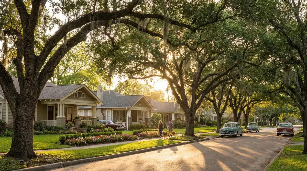
📍
Inside the Loop optimizes for lifestyle and commute. Outside Beltway 8 optimizes for schools and space. Between the loops is the compromise zone. There is no right answer, only trade-offs.
Key Insight
⚠️
2026 MAAPnext Flood Map Update
FEMA's MAAPnext project is expanding Harris County's 100-year floodplain from ~150,000 to ~200,000 acres. When finalized, thousands of properties currently in Zone X (low risk) will be reclassified to Zone AE (high risk), triggering mandatory flood insurance ($3,000-$8,000/yr). Check whether your target address falls within the proposed expanded floodplain at harriscountyfws.org before signing any contract.
Flooding is the single most important factor in choosing where to live in Houston. No other major US city faces this level of recurring flood risk. Houston sits on a flat Gulf coastal plain with clay soil that absorbs almost no water. FEMA classifies flood risk into zones:
Zone AE / A (high risk): 1% annual chance of flooding. Flood insurance through the National Flood Insurance Program is mandatory with a federally-backed mortgage. Annual premiums: $3,000-$8,000+.
Zone X (moderate/minimal risk): Flood insurance is optional but strongly recommended. Annual premiums: $400-$1,200.
Zone VE (coastal high hazard): Storm surge risk. Applies to Clear Lake/League City areas near Galveston Bay.
Critical: about 68% of structures that flooded during Harvey were OUTSIDE the official FEMA 100-year flood zone (HCFCD). Always check address-level flood data at harriscountyfws.org. For more on Houston's climate, see our Houston weather and climate guide. Our Texas property tax guide covers flood insurance implications for your total housing cost.
Flood Risk by Neighborhood
Flood risk assessment for 25 Houston neighborhoods based on FEMA flood zone designations and Hurricane Harvey performance
Neighborhood
FEMA Zone
Harvey Performance
Risk Level
The Heights
Zone X
Very low impact
Low
Montrose
Zone X
Minimal flooding during Harvey
Low
Midtown
Zone X
Minimal flooding
Low
Museum District
Zone X
Some street flooding near Hermann Park
Low-Moderate
Rice Military / Washington Corridor
Zone X (bayou edge risk)
Properties immediately along Buffalo Bayou experienced some flooding
Low-Moderate
EaDo (East Downtown)
Zone X
Very low flooding impact
Low
River Oaks
Mostly Zone X (bayou edge)
Properties along Buffalo Bayou edges experienced flooding
Low-Moderate
West University Place
Zone X
Low structural impact
Low
Bellaire
Mixed X/AE (Brays Bayou risk)
Brays Bayou overflowed catastrophically in some sections
Moderate-High
Garden Oaks / Oak Forest
Zone X
Minimal impact
Low
Timbergrove / Lazybrook
Mixed X/AE (White Oak Bayou)
Properties near White Oak Bayou experienced flooding during Harvey
Moderate
Third Ward / University
Zone X
Relatively low impact
Low
Memorial
Mixed (Addicks reservoir risk)
Sections near Addicks and Barker reservoirs experienced severe flooding during controlled releases
Moderate
Katy
Mostly Zone X (reservoir-adjacent HIGH)
Canyon Gate and Grand Lakes (near Barker reservoir) were devastated by controlled dam releases
Variable
Sugar Land
Zone X (levee protected)
Safe
Low
The Woodlands
Mostly Zone X (Spring Creek HIGH)
Timarron, Creekside Park near Spring Creek experienced devastating flooding
Variable
Pearland
Mixed X/AE
Moderate impact
Moderate
Clear Lake / League City
Zone AE/VE (storm surge risk)
Significant flooding from storm surge and rainfall
HIGH
Cypress
Mostly Zone X
Localized flooding in low-lying areas near Cypress Creek
Low-Moderate
Kingwood
HIGH (San Jacinto River)
CATASTROPHIC
HIGH
Spring / Klein
Mostly Zone X
Some creek flooding along Cypress Creek corridors
Low-Moderate
Missouri City / Sienna
Zone X
Minimal impact
Low
Friendswood
Mixed X/AE (Clear Creek)
Clear Creek flooding affected some subdivisions
Moderate
Tomball
Zone X
Minimal impact
Low
Richmond / Rosenberg
Mixed X/AE (Brazos River)
Brazos River flooding affected some low-lying areas
Moderate
Data from FEMA Flood Map Service Center and Harris County Flood Control District. Always verify address-level data before making housing decisions.
Verified August 2026 · Sources: FEMA MAAPnext (2026 proposed zones), Harris County Flood Control District, HCAD
Most Affordable Houston Neighborhoods in 2026
These neighborhoods sit inside or near the I-610 Loop: Houston's urban core. Higher walkability, shorter commutes, HISD schools, no MUD taxes, and higher price per square foot.
The Heights
Historic charm meets trendy boutiques: the neighborhood that proved Houston could do walkable
1BR Rent
$1,750
Home Price
$695K
$/sqft
$350
Walk / Bike / Transit
75 / 63 / 43
Flood Risk
Low
Property Tax
2.1%
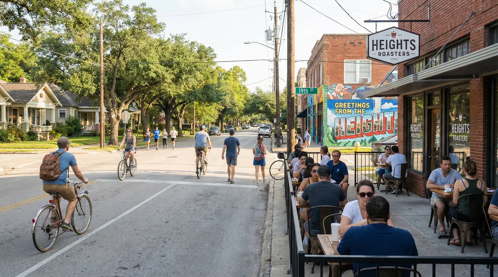
The Heights is Houston's most charming residential neighborhood: tree-lined streets of restored Victorian bungalows, the busy 19th Street shopping corridor, the Saturday morning Heights Farmers Market, and the White Oak Bayou hike-and-bike trail running through its center. Originally a dry community (alcohol sales were banned until voters repealed the prohibition in 2016-2017), the neighborhood has evolved into a family-friendly enclave that still retains walkable nightlife along White Oak and Studewood. Heights home prices have surged over the past decade, but the combination of character, community, and Central Houston access keeps demand strong.
Destination
Rush Hour Drive
Downtown Houston
15 min
Texas Medical Center
25 min
Galleria / Uptown
20 min
Energy Corridor
30 min
IAH Airport
30 min
Hobby Airport
25 min
Young FamiliesCouplesDog OwnersRunners
ISD: Houston ISD (B)
Zoned schools: Harvard Elementary → Hogg MS → Heights HS
Crime (violent / property): 3.2 per 1,000 / 28.1 per 1,000
Patrol: HPD Central
Flood note: Very low impact. Higher elevation relative to surrounding areas. White Oak Bayou stayed within banks in most sections.
MUD tax: No
Nearest grocery: HEB Heights (N Shepherd), Kroger (Heights Blvd)
Nearest hospital: Houston Methodist (15 min)
Montrose
Houston's cultural heartbeat: eclectic, walkable, unapologetically itself
1BR Rent
$1,650
Home Price
$675K
$/sqft
$280
Walk / Bike / Transit
87 / 76 / 58
Flood Risk
Low
Property Tax
2.1%
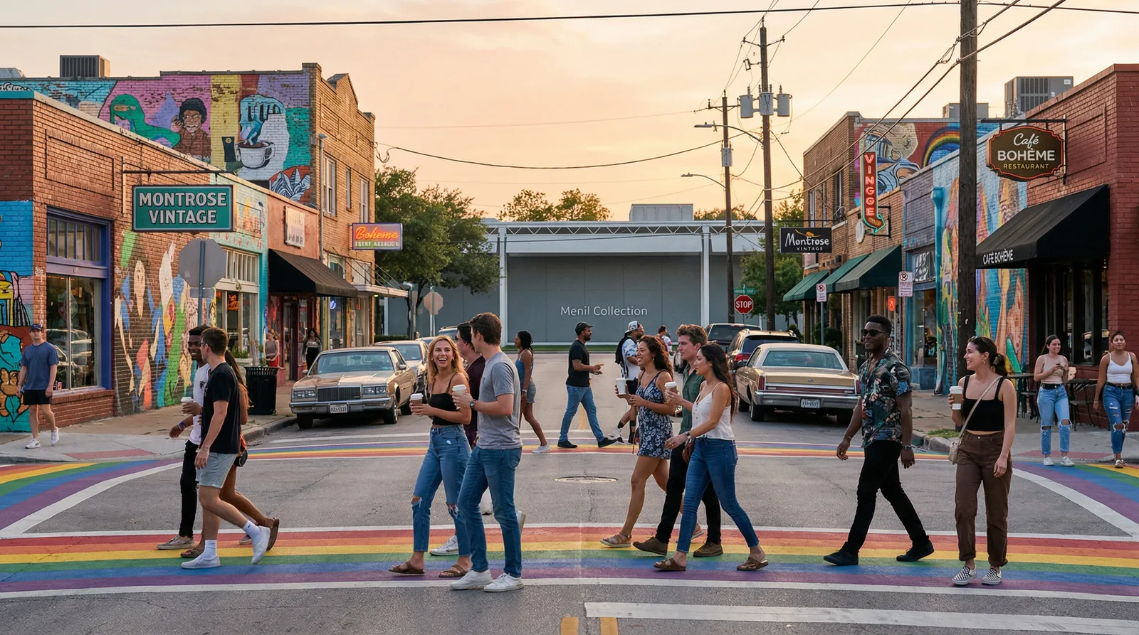
Montrose is Houston's cultural heartbeat: an eclectic, walkable neighborhood where galleries, vintage shops, craft cocktail bars, and taquerias share blocks with historic bungalows and modern townhomes. The dining scene rivals any neighborhood in Texas, with Underbelly Hospitality, Hugo's, and dozens of BYOB spots. Montrose is the center of Houston's LGBTQ+ community, home to the annual Pride parade, and the Menil Collection and Rothko Chapel anchor a world-class arts corridor. Street parking can be competitive on weekends, but day-to-day life here is remarkably walkable by Houston standards.
Destination
Rush Hour Drive
Downtown Houston
10 min
Texas Medical Center
12 min
Galleria / Uptown
15 min
Energy Corridor
25 min
IAH Airport
35 min
Hobby Airport
20 min
Young ProfessionalsArtistsLGBTQ+ CommunityFoodies
ISD: Houston ISD (B)
Zoned schools: Wilson Montrose → Lanier MS → Lamar HS
Crime (violent / property): 4.1 per 1,000 / 35.2 per 1,000
Patrol: HPD Midwest
Flood note: Minimal flooding during Harvey. Most streets drained within 24 hours. One of the best-performing inner-loop neighborhoods.
MUD tax: No
Nearest grocery: HEB Montrose Market, Kroger Shepherd
Nearest hospital: Houston Methodist (10 min)
Midtown
Houston's only car-optional neighborhood: METRORail, bars, and rooftop pools
1BR Rent
$1,800
Home Price
$425K
$/sqft
$301
Walk / Bike / Transit
86 / 73 / 75
Flood Risk
Low
Property Tax
2.1%
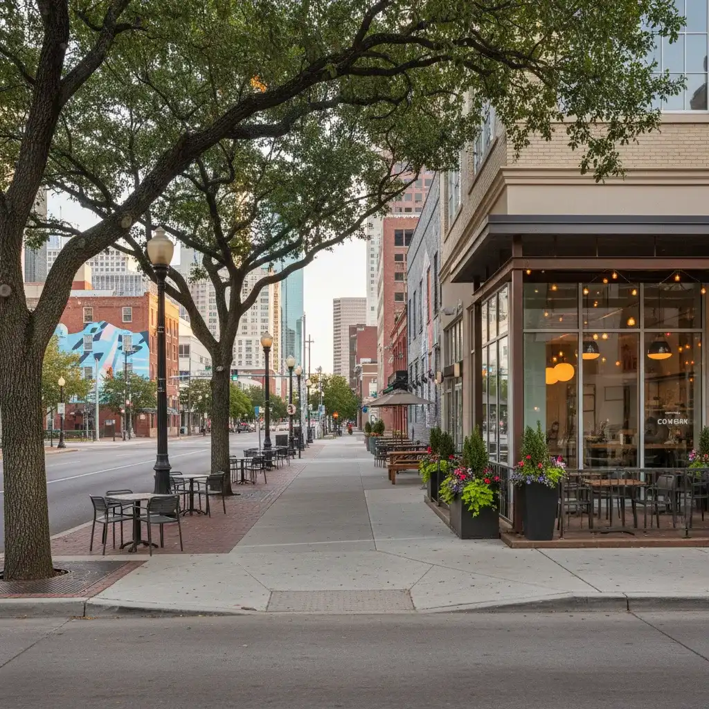
Midtown is Houston's most walkable neighborhood: a dense grid of mid-rise apartments, townhomes, and condos centered along the METRORail Red Line. Bagby Street and the surrounding blocks pack in bars, restaurants, and late-night spots that make it the city's default after-work gathering place for young professionals. It's the only Houston neighborhood where you can genuinely live car-light: the METRORail connects you to Downtown in 5 minutes and the Medical Center in 10. Home prices skew toward condos and townhomes, making it one of the more affordable inner-loop entry points for buyers.
Destination
Rush Hour Drive
Downtown Houston
5 min
Texas Medical Center
10 min
Galleria / Uptown
20 min
Energy Corridor
30 min
IAH Airport
35 min
Hobby Airport
18 min
SinglesYoung ProfessionalsNightlifeTransit Users
ISD: Houston ISD (B)
Zoned schools: Blackshear Elementary → Ryan MS → Jack Yates HS
Crime (violent / property): 5.8 per 1,000 / 42.3 per 1,000
Patrol: HPD South Central
Flood note: Minimal flooding. METRORail continued operating through most of the storm. Street-level water receded quickly.
MUD tax: No
Nearest grocery: Kroger Midtown (Gray St), HEB nearby
Nearest hospital: Ben Taub (10 min)
Museum District
19 world-class museums, Hermann Park, and a 5-minute TMC commute
1BR Rent
$1,950
Home Price
$780K
$/sqft
$280
Walk / Bike / Transit
79 / 78 / 64
Flood Risk
Low-Moderate
Property Tax
2.2%
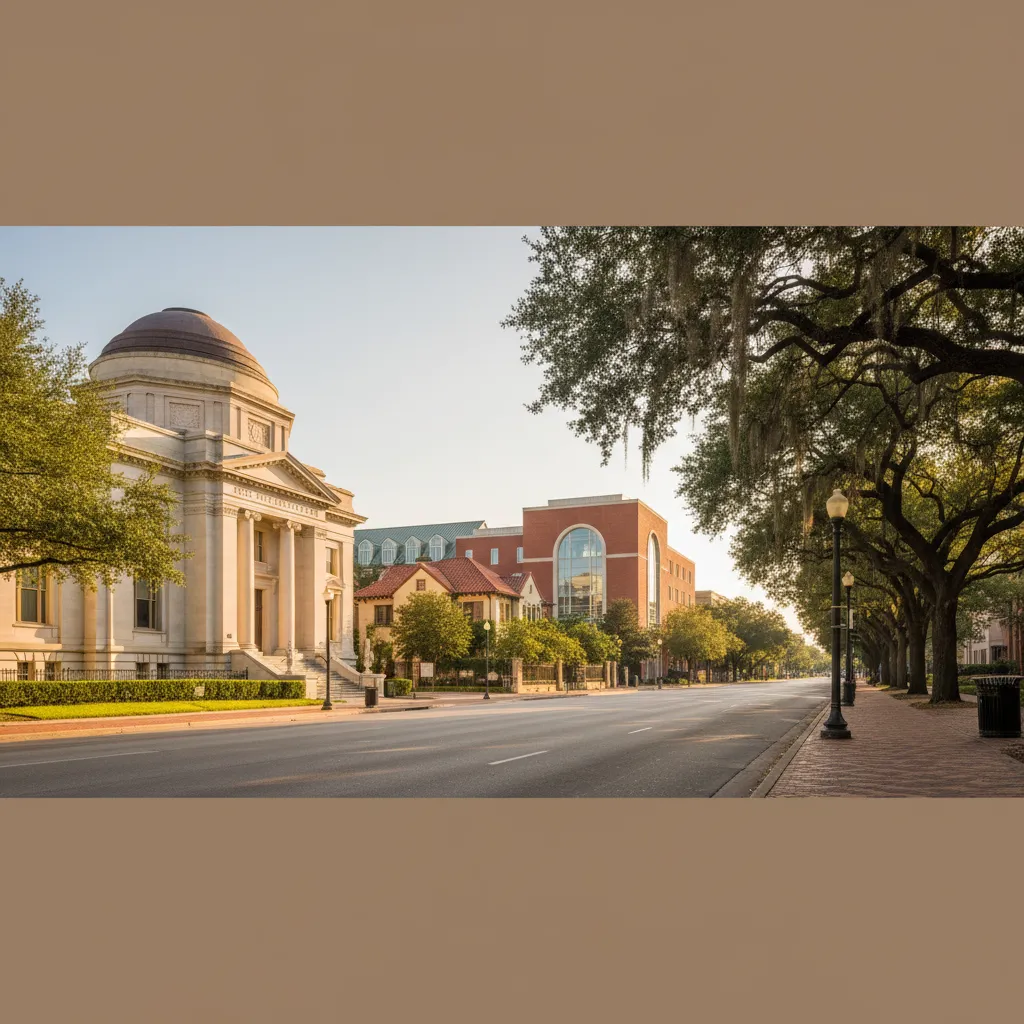
The Museum District is Houston's cultural crown jewel: 19 institutions including the Museum of Fine Arts Houston, the Houston Museum of Natural Science, the Children's Museum, and the Contemporary Arts Museum line a walkable corridor adjacent to Hermann Park and the Houston Zoo. For Texas Medical Center employees, this is the premier residential location: a 5-minute commute on foot, bike, or METRORail. The housing mix ranges from grand historic homes along Main Street to modern apartment towers. Rice University's campus anchors the southern edge, creating an academic, leafy atmosphere uncommon in Houston.
Destination
Rush Hour Drive
Downtown Houston
10 min
Texas Medical Center
5 min
Galleria / Uptown
15 min
Energy Corridor
25 min
IAH Airport
35 min
Hobby Airport
15 min
Medical Center WorkersCulture LoversFamiliesAcademics
ISD: Houston ISD (B)
Zoned schools: Roberts Elementary → Pin Oak MS → Lamar HS
Crime (violent / property): 2.8 per 1,000 / 24.6 per 1,000
Patrol: HPD South Central + Rice U PD
Flood note: Some street flooding near Hermann Park. Most residential structures unaffected. TMC nearby experienced more significant issues.
MUD tax: No
Nearest grocery: HEB Buffalo Speedway, Trader Joe's Shepherd
Nearest hospital: Texas Medical Center (5 min)
Rice Military / Washington Corridor
Washington Ave energy meets Buffalo Bayou trails: Houston's hottest restaurant corridor
1BR Rent
$1,900
Home Price
$550K
$/sqft
$290
Walk / Bike / Transit
76 / 60 / 46
Flood Risk
Low-Moderate
Property Tax
2.1%
Rice Military and the Washington Corridor have transformed from a quiet residential area into one of Houston's most dynamic neighborhoods. Washington Avenue pulses with restaurants, bars, and boutiques that draw crowds from across the city. Buffalo Bayou Park (160 acres of trails, art installations, dog parks, and kayak launches) borders the neighborhood to the south, creating some of the best outdoor recreation access inside the Loop. New-construction townhomes dominate the housing stock, with three-story modern builds replacing older bungalows at a rapid pace. The mix of dining, trail access, and central location makes this one of the hottest neighborhoods for 28-40 year old professionals.
Destination
Rush Hour Drive
Downtown Houston
10 min
Texas Medical Center
20 min
Galleria / Uptown
15 min
Energy Corridor
20 min
IAH Airport
30 min
Hobby Airport
25 min
Young ProfessionalsCouplesFoodiesTrail Users
ISD: Houston ISD (B)
Zoned schools: Hogg Elementary → Hogg MS → Heights HS
Crime (violent / property): 3.5 per 1,000 / 30.1 per 1,000
Patrol: HPD Central
Flood note: Properties immediately along Buffalo Bayou experienced some flooding. Interior streets largely unaffected. Post-Harvey mitigation along bayou completed.
Breweries, murals, and Dynamo matchdays: Houston's fastest-gentrifying zip code
1BR Rent
$1,650
Home Price
$440K
$/sqft
$220
Walk / Bike / Transit
72 / 80 / 63
Flood Risk
Low
Property Tax
2.1%
EaDo is Houston's fastest-gentrifying neighborhood: a former warehouse district rapidly converting into craft breweries (8th Wonder, True Anomaly), street-art murals, live-music venues, and new-construction townhomes. Shell Energy Stadium (Houston Dynamo) anchors the eastern edge, and the METRORail Green and Purple Lines provide direct connections to the Theater District and Southeast Houston. Navigation Boulevard's original Tex-Mex restaurants (El Ultimo, Original Ninfa's) provide culinary heritage alongside newer arrivals. EaDo offers inner-loop proximity at prices significantly below Montrose or the Heights, though school ratings within HISD remain below average for the area.
Destination
Rush Hour Drive
Downtown Houston
5 min
Texas Medical Center
15 min
Galleria / Uptown
25 min
Energy Corridor
35 min
IAH Airport
35 min
Hobby Airport
15 min
MillennialsCraft BeerCreativesValue Seekers
ISD: Houston ISD (C)
Zoned schools: Bastian Elementary → Deady MS → Austin HS
Crime (violent / property): 6.2 per 1,000 / 38.7 per 1,000
Patrol: HPD Southeast
Flood note: Very low flooding impact. Newer construction in EaDo benefited from updated drainage standards.
MUD tax: No
Nearest grocery: HEB Navigation Blvd, Fiesta Mart Harrisburg
Nearest hospital: Ben Taub (15 min)
River Oaks
Old Houston money, gated estates, Buffalo Bayou Park: the most exclusive address in Texas
1BR Rent
$2,600
Home Price
$2.6M+
$/sqft
$565
Walk / Bike / Transit
44 / 42 / 43
Flood Risk
Low-Moderate
Property Tax
2.2%
River Oaks is Houston's wealthiest neighborhood: gated estates, manicured lawns, and some of the most expensive residential real estate in the Southern United States. Home to oil tycoons, corporate CEOs, and old Houston money, River Oaks maintains strict deed restrictions that function like zoning in a city that technically has none. Elite private schools like St. John's School and The Kinkaid School anchor the education scene. The River Oaks District and Highland Village provide luxury retail. Buffalo Bayou Park, one of the city's best green spaces, borders the neighborhood to the south with 160 acres of trails, art installations, and kayak access.
Destination
Rush Hour Drive
Downtown Houston
15 min
Texas Medical Center
20 min
Galleria / Uptown
10 min
Energy Corridor
20 min
IAH Airport
35 min
Hobby Airport
25 min
Ultra-WealthyExecutivesPrivate School Families
ISD: Houston ISD (B)
Zoned schools: River Oaks Elementary → Lanier MS → Lamar HS
Crime (violent / property): 1.2 per 1,000 / 18.4 per 1,000
Patrol: HPD Midwest + Private Security
Flood note: Properties along Buffalo Bayou edges experienced flooding. Interior streets largely unaffected. Post-Harvey flood mitigation along bayou completed.
MUD tax: No
Nearest grocery: River Oaks HEB (planned), Whole Foods Kirby
Nearest hospital: Houston Methodist (8 min)
West University Place
Houston's safest city-within-a-city: own PD, top elementary, 5-min TMC commute
1BR Rent
$2,100
Home Price
$1.65M
$/sqft
$547
Walk / Bike / Transit
85 / 62 / 35
Flood Risk
Low
Property Tax
2.3%
West University Place, known locally as West U, is an independent city of 15,000 residents completely surrounded by Houston. It maintains its own police department, fire department, and public works, giving it a small-town governance feel with big-city proximity. West U Elementary is consistently rated among the top public elementary schools in Texas. The neighborhood is adjacent to Rice University and Rice Village shopping, with a 5-minute commute to the Medical Center. West U is notable for having deed restrictions that function as de facto zoning (rare in Greater Houston), keeping the residential character uniform and predictable. It is routinely ranked among the safest cities in Texas.
Zoned schools: West U Elementary → Pershing MS → Lamar HS
Crime (violent / property): 0.8 per 1,000 / 12.1 per 1,000
Patrol: West U PD (independent)
Flood note: Low structural impact. West U's independent drainage infrastructure and slightly higher elevation kept most homes dry.
MUD tax: No
Nearest grocery: Kroger University Blvd, Rice Village
Nearest hospital: Texas Medical Center (5 min)
Bellaire
Independent city with its own PD, Chinatown-adjacent dining, and Bellaire HS prestige, but verify flood history
1BR Rent
$1,600
Home Price
$750K
$/sqft
$300
Walk / Bike / Transit
52 / 49 / 47
Flood Risk
Moderate-High
Property Tax
2.2%
Bellaire is an independent city within Houston with its own police department and civic services, offering a 15-minute TMC commute that has made it popular with physicians and hospital staff for decades. The housing stock features large ranch-style homes on generous lots, many rebuilt on raised foundations post-Harvey. The neighborhood anchors Houston's Chinatown-adjacent dining corridor with extraordinary Asian cuisine diversity, from dim sum to pho to Korean BBQ. Bellaire High School is one of the most academically competitive public high schools in Texas. Warning: this area carries flood risk along Brays Bayou. Multiple flooding events (2015, 2016, Harvey 2017) caused significant damage in low-lying sections. You MUST verify address-level flood history and budget for flood insurance in Zone AE areas.
Zoned schools: Horn Elementary → Pin Oak MS → Bellaire HS
Crime (violent / property): 2.1 per 1,000 / 22.4 per 1,000
Patrol: Bellaire PD (independent)
Flood note: Brays Bayou overflowed catastrophically in some sections. Many homes in low-lying areas took 4-6 feet of water. Hundreds rebuilt on elevated foundations. Higher-ground properties were largely unaffected.
MUD tax: No
Nearest grocery: HEB Bellaire, 99 Ranch Market, H Mart
Nearest hospital: Texas Medical Center (15 min)
Garden Oaks / Oak Forest
Quiet, shaded streets with mid-century ranch homes: the Heights' affordable neighbor
1BR Rent
$1,500
Home Price
$450K
$/sqft
$250
Walk / Bike / Transit
50 / 54 / 32
Flood Risk
Low
Property Tax
2.1%
Garden Oaks and the adjacent Oak Forest neighborhood offer a quieter, more affordable alternative to the Heights just to the south. Wide, shaded streets lined with mid-century ranch homes on generous lots under mature live oak canopy create a distinctly suburban feel while remaining firmly inside the Loop. The Garden Oaks Montessori magnet school is a significant draw for families, consistently ranking among the best HISD elementary campuses. An active civic club organizes block parties, home tours, and community garden events. With median homes around $450K (nearly $250K less than the Heights) and solid Zone X flood protection, Garden Oaks represents one of the best value propositions for first-time buyers who want inner-loop proximity without Heights pricing.
Destination
Rush Hour Drive
Downtown Houston
20 min
Texas Medical Center
25 min
Galleria / Uptown
20 min
Energy Corridor
25 min
IAH Airport
25 min
Hobby Airport
30 min
Young FamiliesFirst-Time BuyersGardenersCommunity-Minded
ISD: Houston ISD (B)
Zoned schools: Garden Oaks Montessori → Black MS → Heights HS
Crime (violent / property): 2.5 per 1,000 / 20.3 per 1,000
Patrol: HPD North
Flood note: Minimal impact. Higher elevation and improved drainage kept nearly all homes dry during Harvey.
MUD tax: No
Nearest grocery: HEB N Shepherd, Sprouts
Nearest hospital: HCA Houston Northwest (15 min)
Timbergrove / Lazybrook
White Oak Bayou trail access, Heights character at lower prices: check flood maps block-by-block
1BR Rent
$1,450
Home Price
$450K
$/sqft
$250
Walk / Bike / Transit
55 / 50 / 30
Flood Risk
Moderate
Property Tax
2.1%
Timbergrove and Lazybrook sit just west of the Heights, sharing the same tree-lined residential character and Heights High School feeder pattern but at notably lower price points. White Oak Bayou Greenway runs directly through the neighborhood, giving residents immediate access to one of Houston's best hike-and-bike trail systems, perfect for runners, cyclists, and dog walkers. The housing stock is a mix of original 1950s ranch homes and new-construction townhomes replacing teardowns. The key caveat is flood risk: White Oak Bayou creates a band of Zone AE floodplain through the neighborhood. Properties a few blocks from the bayou in Zone X are excellent values, but buyers must check flood maps at the address level. This is where Heights-priced-out families are finding their foothold.
Destination
Rush Hour Drive
Downtown Houston
20 min
Texas Medical Center
25 min
Galleria / Uptown
18 min
Energy Corridor
22 min
IAH Airport
25 min
Hobby Airport
30 min
Young FamiliesTrail UsersHeights-Priced-Out Buyers
ISD: Houston ISD (B)
Zoned schools: Sinclair Elementary → Black MS → Heights HS
Crime (violent / property): 2.9 per 1,000 / 23.1 per 1,000
Patrol: HPD North
Flood note: Properties near White Oak Bayou experienced flooding during Harvey. Interior blocks on higher ground were largely unaffected. Block-by-block verification essential.
MUD tax: No
Nearest grocery: Kroger Ella, HEB N Shepherd
Nearest hospital: Houston Methodist (20 min)
Third Ward / University
Historic Black cultural district + University of Houston campus: rapidly gentrifying with the most affordable inner-loop prices
1BR Rent
$1,200
Home Price
$280K
$/sqft
$180
Walk / Bike / Transit
65 / 55 / 50
Flood Risk
Low
Property Tax
2.1%
Third Ward is Houston's historic Black cultural district, home to the University of Houston campus, the Emancipation Park (the oldest public park in Texas), and a growing arts scene centered around Project Row Houses. The neighborhood is undergoing rapid transformation as UH expansion, METRORail Purple Line access, and new townhome construction attract a wave of investment and new residents. At a median home price of $280K, Third Ward offers the most affordable inner-loop real estate in Houston, nearly half the price of the next cheapest option. Crime runs higher here than in most neighborhoods in this guide, particularly farther from campus, but UH PD supplements HPD patrol in the university area and residents near campus report steadily improving conditions. For buyers willing to accept transitional-neighborhood dynamics, Third Ward represents the strongest appreciation potential inside the Loop.
Destination
Rush Hour Drive
Downtown Houston
10 min
Texas Medical Center
10 min
Galleria / Uptown
20 min
Energy Corridor
30 min
IAH Airport
35 min
Hobby Airport
15 min
UH Faculty/StaffInvestorsArtistsBudget Inner-Loop
ISD: Houston ISD (B)
Zoned schools: Blackshear Elementary → Ryan MS → Jack Yates HS
Crime (violent / property): 7.8 per 1,000 / 41.2 per 1,000
Patrol: HPD South Central + UH PD
Flood note: Relatively low impact. Higher elevation and improved UH campus drainage helped. Some localized street flooding but minimal structural damage.
MUD tax: No
Nearest grocery: HEB MacGregor, Fiesta Mart Scott St
Not sure which neighborhood fits? Houston Corporate Housing offers fully furnished apartments across multiple Houston neighborhoods. Try before you commit. All utilities included, no long-term lease required.
These neighborhoods sit outside or straddling Beltway 8: Houston's outer ring. Top-rated school districts, master-planned communities, more space, longer commutes, and MUD taxes in most areas.
Memorial
Half-acre lots, Memorial Park trails, Spring Branch ISD: Houston's premier family neighborhood
1BR Rent
$1,850
Home Price
$1.3M+
$/sqft
$238
Walk / Bike / Transit
30 / 45 / 35
Flood Risk
Moderate
Property Tax
2.4%
Memorial is Houston's premier family neighborhood: enormous lots (often half-acre or more), mature live oaks, and access to Spring Branch ISD, which consistently ranks among the top school districts in Harris County. Memorial Park, at 1,500 acres, is one of the largest urban parks in the country and offers running trails, a golf course, tennis courts, and mountain biking. The neighborhood is car-dependent but that trade-off buys space, privacy, and schools that rival any suburban district. Critical caveat: Memorial's western sections near the Addicks and Barker reservoirs were heavily impacted during Harvey's controlled releases. Buyers must verify subdivision-level flood history before purchasing.
Destination
Rush Hour Drive
Downtown Houston
20 min
Texas Medical Center
30 min
Galleria / Uptown
15 min
Energy Corridor
15 min
IAH Airport
35 min
Hobby Airport
35 min
FamiliesTop School SeekersExecutivesNature Lovers
ISD: Spring Branch ISD (B)
Zoned schools: Frostwood Elementary → Memorial MS → Memorial HS
Crime (violent / property): 1.4 per 1,000 / 16.8 per 1,000
Patrol: HPD Memorial + Constable Pct 5
Flood note: Sections near Addicks and Barker reservoirs experienced severe flooding during controlled releases. Areas south of I-10 and east of Beltway 8 fared best. Always verify specific subdivision history.
MUD tax: Rare
Nearest grocery: HEB Memorial Bunker Hill, Kroger Memorial
Nearest hospital: Memorial Hermann Katy (15 min)
Katy
Undisputed champion of Houston suburban family living: TEA B-rated schools, resort amenities, MUD tax trade-off
1BR Rent
$1,400
Home Price
$415K
$/sqft
$158
Walk / Bike / Transit
20 / 35 / 0
Flood Risk
Variable
Property Tax
3.3%
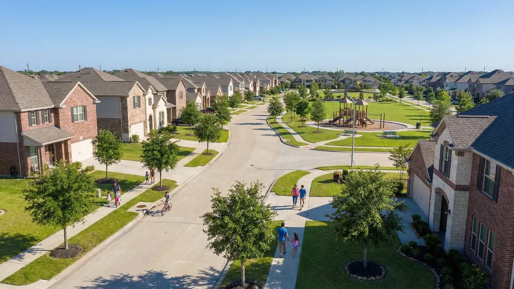
Katy is the undisputed champion of Houston suburban family living: Katy ISD earns a TEA accountability rating of B (88/100) and consistently ranks among the top school districts in Texas. Master-planned communities like Cinco Ranch, Cross Creek Ranch, Cane Island, and Elyson offer resort-style amenities: community pools, splash pads, fitness centers, lakes, and organized social events. Katy Mills Mall provides shopping, and the developing LaCenterra at Cinco Ranch delivers a walkable town-center experience. The trade-off is commute time (45+ minutes to Downtown) and MUD taxes that push total property tax rates to 3.2-3.5%, significantly higher than inner-loop neighborhoods. Flood risk varies dramatically: always verify whether a subdivision is near the Addicks-Barker reservoirs.
Destination
Rush Hour Drive
Downtown Houston
45 min
Texas Medical Center
60 min
Galleria / Uptown
35 min
Energy Corridor
15 min
IAH Airport
50 min
Hobby Airport
55 min
FamiliesTop School SeekersMaster-Plan Lifestyle
ISD: Katy ISD (B)
Zoned schools: Varies by MPC: Cinco Ranch HS, Tompkins HS, Seven Lakes HS
Crime (violent / property): 1.1 per 1,000 / 14.2 per 1,000
Patrol: Harris Co. Pct 5 Constable + HOA
Flood note: Canyon Gate and Grand Lakes (near Barker reservoir) were devastated by controlled dam releases. Cinco Ranch and newer master-planned communities farther west were largely unaffected.
MUD tax: Heavy (3.2%-3.5% total)
Nearest grocery: HEB Katy (multiple), Kroger
Nearest hospital: Houston Methodist West (10 min)
Sugar Land
America's most diverse suburb: TEA B-rated schools, levee-protected low flood risk, extraordinary culinary diversity
1BR Rent
$1,650
Home Price
$460K
$/sqft
$180
Walk / Bike / Transit
28 / 46 / 0
Flood Risk
Low
Property Tax
2.8%
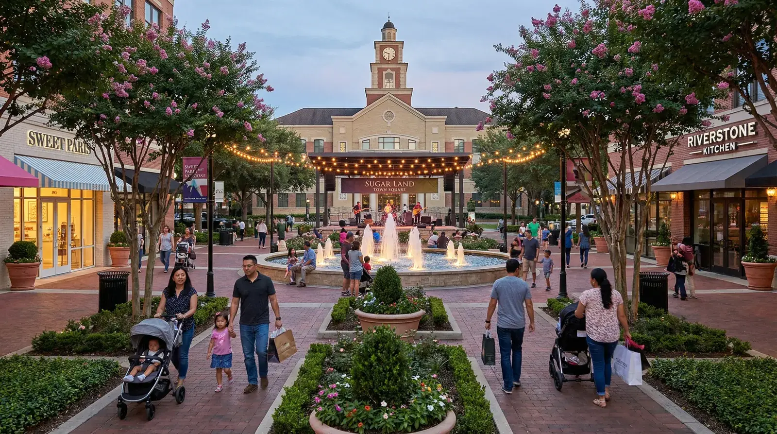
Sugar Land is one of the most ethnically diverse and safest suburbs in the United States: Fort Bend County's demographics mirror no majority, with large South Asian, Chinese, Nigerian, and Hispanic communities that shape everything from the grocery anchors to the restaurant rows. Fort Bend ISD earns a TEA accountability rating of B (80/100) and rivals Katy ISD for academic excellence. The Smart Financial Centre brings major concerts and entertainment. Sugar Land Town Square provides a walkable town-center experience with restaurants, shops, and civic events. The levee-protected Brazos River corridor means Sugar Land has some of the lowest flood risk in Greater Houston, a significant advantage for insurance costs and peace of mind.
Destination
Rush Hour Drive
Downtown Houston
40 min
Texas Medical Center
35 min
Galleria / Uptown
30 min
Energy Corridor
25 min
IAH Airport
55 min
Hobby Airport
30 min
Diverse FamiliesAsian/South Asian CommunitiesSafety SeekersRetirees
Crime (violent / property): 0.9 per 1,000 / 13.5 per 1,000
Patrol: Sugar Land PD
Flood note: Safe. Less than 1% of homes experienced flooding. The Brazos River levee system held throughout Harvey. Sugar Land is one of the best-performing Houston suburbs during flooding events.
MUD tax: LID (lower than MUD)
Nearest grocery: HEB Sugar Land, H Mart, 99 Ranch Market
Nearest hospital: Houston Methodist Sugar Land (10 min)
The Woodlands
28,000-acre master-planned forest city: 200+ miles of trails, self-contained amenities, 50-min DT commute
1BR Rent
$1,750
Home Price
$580K
$/sqft
$220
Walk / Bike / Transit
18 / 40 / 0
Flood Risk
Variable
Property Tax
2.7%
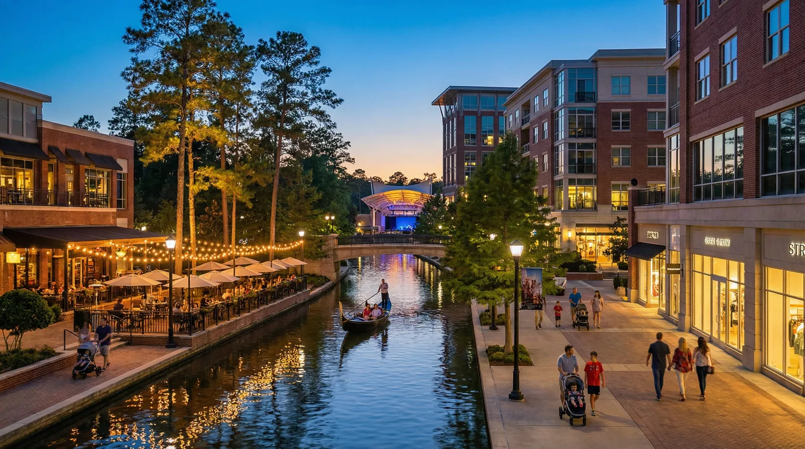
The Woodlands is a 28,000-acre master-planned community that runs like a self-contained city, with its own corporate campuses (ExxonMobil, Hewitt Associates, Chevron Phillips), a performing arts center (The Cynthia Woods Mitchell Pavilion), shopping (The Woodlands Mall, Market Street), and over 200 miles of hike-and-bike trails winding through a thick pine-forest canopy. The community is divided into villages, each with its own character and amenities. Conroe ISD earns a TEA accountability rating of B (85/100) and The Woodlands High School is among the highest-performing in Texas. The Waterway provides an urban-feel town center with restaurants, hotels, and water taxis. The trade-off is commute time (50+ minutes to Downtown Houston), though the ExxonMobil campus and growing North Houston employment base reduce this for many residents.
Zoned schools: Varies by village: The Woodlands HS, College Park HS
Crime (violent / property): 0.7 per 1,000 / 15.1 per 1,000
Patrol: Montgomery Co. Constable + HOA
Flood note: Timarron, Creekside Park near Spring Creek experienced devastating flooding. Interior villages on higher ground were largely unaffected. Village-level research is essential.
MUD tax: Yes
Nearest grocery: HEB Woodlands (multiple), Kroger, Whole Foods
Nearest hospital: Houston Methodist The Woodlands (5 min)
Pearland
Best suburban TMC commute at 25 minutes: diverse, affordable, and rapidly growing
1BR Rent
$1,500
Home Price
$375K
$/sqft
$152
Walk / Bike / Transit
25 / 35 / 0
Flood Risk
Moderate
Property Tax
2.9%
Pearland is the best suburban option for Texas Medical Center commuters: a 25-minute drive via Highway 288 that undercuts every other suburb by 10-30 minutes. This fast-growing community south of Houston has attracted a remarkably diverse population, with strong South Asian, Hispanic, and African American communities supporting excellent international dining. Pearland ISD earns a TEA accountability rating of A and continues to invest in new schools as the population grows. Shadow Creek Ranch and Silverlake are the signature master-planned communities. Home prices averaging $375K make Pearland one of the most affordable options with a quality school district in Greater Houston. Hobby Airport is just 15 minutes away.
Zoned schools: Varies: Pearland HS, Dawson HS, Shadow Creek HS
Crime (violent / property): 1.3 per 1,000 / 17.2 per 1,000
Patrol: Pearland PD
Flood note: Moderate impact. Some older subdivisions near Clear Creek took water. Newer master-planned communities with improved drainage fared better.
MUD tax: Yes
Nearest grocery: HEB Pearland, Kroger, H Mart
Nearest hospital: Memorial Hermann Pearland (10 min)
Clear Lake / League City
NASA Johnson Space Center, bay-view dining, STEM academies, but budget for storm surge risk
1BR Rent
$1,400
Home Price
$365K
$/sqft
$178
Walk / Bike / Transit
30 / 35 / 0
Flood Risk
HIGH
Property Tax
2.8%
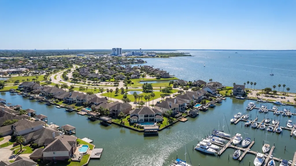
Clear Lake and League City form the heart of Houston's aerospace community: NASA Johnson Space Center is the area's anchor employer, surrounded by dozens of defense contractors (Boeing, Lockheed Martin, Jacobs) and STEM-focused businesses. Clear Creek ISD operates specialized STEM academies that feed directly into the aerospace pipeline. Kemah Boardwalk and Galveston Bay provide a waterfront lifestyle with boating, fishing, and bay-view dining unique among Houston suburbs. The trade-off is significant: this area carries HIGH storm surge risk from Gulf hurricanes. Zone AE and VE flood designations mean mandatory flood insurance and substantially higher premiums. Inland League City subdivisions on higher ground carry lower (but still elevated) risk.
Destination
Rush Hour Drive
Downtown Houston
40 min
Texas Medical Center
45 min
Galleria / Uptown
50 min
Energy Corridor
55 min
IAH Airport
55 min
Hobby Airport
25 min
NASA/STEM WorkersBoatersBay Area Lifestyle
ISD: Clear Creek ISD (B)
Zoned schools: Varies: Clear Lake HS, Clear Springs HS, Clear Creek HS
Crime (violent / property): 1.5 per 1,000 / 18.9 per 1,000
Patrol: LPPD + Nassau Bay PD
Flood note: Significant flooding from storm surge and rainfall. Coastal areas and low-lying subdivisions took substantial water. Inland League City areas fared better.
MUD tax: Yes
Nearest grocery: HEB League City, Kroger Clear Lake
Nearest hospital: HCA Clear Lake (10 min)
Cypress
Towne Lake paddleboarding, Bridgeland trails, Cy-Fair ISD: fastest-growing suburb with heavy MUD taxes
1BR Rent
$1,550
Home Price
$430K
$/sqft
$145
Walk / Bike / Transit
15 / 25 / 0
Flood Risk
Low-Moderate
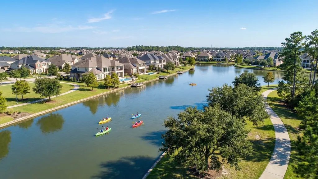
Property Tax
3.2%
Cypress is one of Houston's fastest-growing suburban communities: master-planned developments like Bridgeland, Towne Lake (with its 300-acre recreational lake for kayaking and paddleboarding), and Cypress Creek Lakes deliver resort-style amenities and newer construction. Cy-Fair ISD earns a TEA accountability rating of B (85/100) and is the third-largest school district in Texas, with strong academics and athletics programs. The area offers a good balance of suburban space and retail convenience, with a growing restaurant scene along Highway 290. Cypress buyers should budget for heavy MUD taxes, which push total property tax rates above 3%, and understand that car dependency is absolute, with the lowest walk scores in Greater Houston.
Crime (violent / property): 1.0 per 1,000 / 15.6 per 1,000
Patrol: Harris Co. Constable Pct 4
Flood note: Localized flooding in low-lying areas near Cypress Creek. Master-planned communities like Bridgeland, designed with modern detention, performed well.
The Livable Forest: 75+ miles of trails, pine canopy, Lake Houston, but HIGH flood risk from the San Jacinto
1BR Rent
$1,400
Home Price
$385K
$/sqft
$150
Walk / Bike / Transit
20 / 30 / 0
Flood Risk
HIGH
Property Tax
2.5%
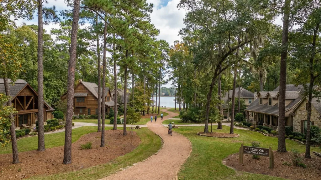
Kingwood markets itself as "The Livable Forest," and the name is earned. Thick pine forests, 75+ miles of hike-and-bike trails, and Lake Houston access create a nature-immersed lifestyle unique among Houston suburbs. The community features extensive greenbelt corridors, community pools, and golf courses woven through residential villages. Humble ISD carries a TEA B rating with strong individual schools like Kingwood High School and Kingwood Park. IAH Airport is just 20 minutes away. Critical warning: Kingwood carries HIGH flood risk due to its proximity to the San Jacinto River and Lake Houston. During Harvey, controlled releases from Lake Conroe sent catastrophic water levels through Kingwood neighborhoods. Buyers MUST verify subdivision-level flood history and budget for mandatory flood insurance.
Zoned schools: Varies: Kingwood HS, Kingwood Park HS
Crime (violent / property): 0.9 per 1,000 / 11.8 per 1,000
Patrol: HPD Kingwood + Constable
Flood note: CATASTROPHIC. Lake Conroe dam releases combined with San Jacinto River flooding inundated hundreds of homes. Some subdivisions took 6+ feet of water. Significant rebuilding has occurred but risk remains.
MUD tax: No
Nearest grocery: HEB Kingwood, Kroger Kingwood
Nearest hospital: HCA Kingwood (10 min)
Spring / Klein
Strong suburban value with Klein ISD schools and ExxonMobil campus proximity
1BR Rent
$1,450
Home Price
$350K
$/sqft
$155
Walk / Bike / Transit
20 / 30 / 0
Flood Risk
Low-Moderate
Property Tax
2.7%
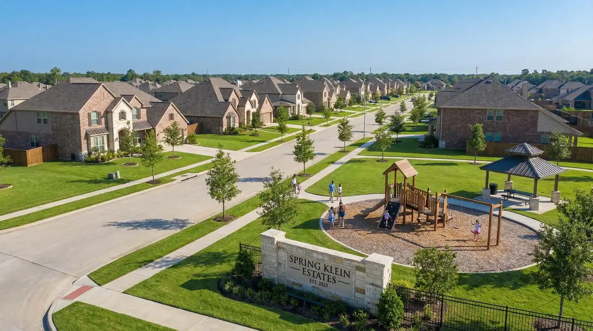
Spring and Klein offer strong suburban value northwest of Houston: Klein ISD earns a TEA accountability rating of B (86/100), housing costs are among the lowest for a quality school district, and the ExxonMobil Spring campus (~8,000 employees) has turned the area into a major employment node. Proximity to IAH Airport (20 minutes) is a significant advantage for frequent business travelers. New master-planned communities like Balmoral and Lakes at Creekside offer modern amenities while established neighborhoods provide character and mature landscaping. The area continues to attract families priced out of The Woodlands who want similar school quality at a lower price point.
Destination
Rush Hour Drive
Downtown Houston
45 min
Texas Medical Center
60 min
Galleria / Uptown
35 min
Energy Corridor
40 min
IAH Airport
20 min
Hobby Airport
50 min
Value SeekersExxonMobil WorkersIAH Commuters
ISD: Klein ISD (B)
Zoned schools: Varies: Klein HS, Klein Oak HS, Klein Collins HS
Crime (violent / property): 1.8 per 1,000 / 19.4 per 1,000
Patrol: Harris Co. Constable Pct 4
Flood note: Some creek flooding along Cypress Creek corridors. Master-planned communities on higher ground were largely unaffected.
Fort Bend ISD quality at lower prices than Sugar Land; Sienna is the standout MPC
1BR Rent
$1,350
Home Price
$350K
$/sqft
$150
Walk / Bike / Transit
15 / 20 / 0
Flood Risk
Low
Property Tax
3.0%
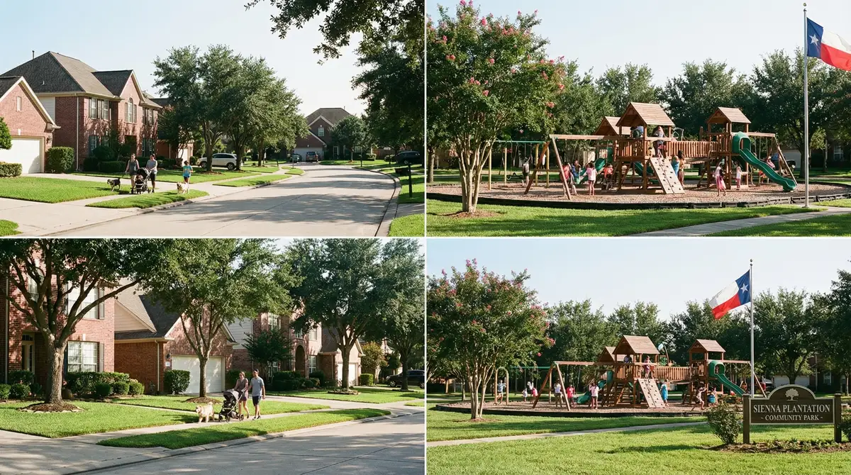
Missouri City and the Sienna master-planned community deliver Fort Bend ISD school quality at prices $100K+ below neighboring Sugar Land. Sienna is the standout: a 7,000-acre master-planned community with resort pools, splash pads, fitness centers, and miles of trails. The community's diverse population mirrors Fort Bend County's status as one of the most ethnically diverse counties in the nation. Ridge Point High School is particularly strong academically. The TMC commute at 30 minutes is competitive with much more expensive inner-loop options. Low flood risk (Zone X) and established drainage infrastructure make Missouri City a safe bet. The primary trade-offs are slightly higher crime rates than Sugar Land and MUD taxes that push total property tax to 3.0%.
Zoned schools: Varies: Ridge Point HS, Hightower HS, Marshall HS
Crime (violent / property): 2.1 per 1,000 / 18.7 per 1,000
Patrol: Missouri City PD
Flood note: Minimal impact. Most Missouri City subdivisions sit on higher ground with modern drainage infrastructure.
MUD tax: Yes
Nearest grocery: HEB Missouri City, Kroger
Nearest hospital: Memorial Hermann Sugar Land (15 min)
Friendswood
Small-town Texas charm with some of the lowest crime rates in the metro: the safe suburb pick
1BR Rent
$1,500
Home Price
$420K
$/sqft
$175
Walk / Bike / Transit
22 / 30 / 0
Flood Risk
Moderate
Property Tax
2.6%
Friendswood is Houston's small-town gem: a tight-knit community of 40,000 that consistently ranks among the safest cities in Texas. With violent crime at just 0.6 per 1,000 residents and property crime under 10 per 1,000, Friendswood has the lowest crime rates of any community profiled in this guide. Friendswood ISD is rated A and delivers the personal attention of a smaller district. The downtown area retains charming Texas Main Street character with local shops and restaurants. Clear Creek runs through the community, creating both green space and a flood consideration; verify address-level flood zones. For families who prioritize safety above all else and work in the Bay Area or Medical Center corridor, Friendswood is the standout pick.
Destination
Rush Hour Drive
Downtown Houston
40 min
Texas Medical Center
35 min
Galleria / Uptown
45 min
Energy Corridor
55 min
IAH Airport
55 min
Hobby Airport
20 min
Safety-Conscious FamiliesSmall-Town FeelBay Area Workers
ISD: Friendswood ISD / Clear Creek ISD (A)
Zoned schools: Friendswood HS
Crime (violent / property): 0.6 per 1,000 / 9.8 per 1,000
Patrol: Friendswood PD
Flood note: Clear Creek flooding affected some subdivisions. Properties away from creek corridors on higher ground were largely unaffected.
MUD tax: Limited
Nearest grocery: HEB Friendswood, Kroger
Nearest hospital: HCA Clear Lake (15 min)
Tomball
Historic downtown charm, Tomball ISD quality, strong value northwest of Houston
1BR Rent
$1,350
Home Price
$380K
$/sqft
$155
Walk / Bike / Transit
18 / 25 / 0
Flood Risk
Low
Property Tax
2.7%
Tomball retains a charming small-town Texas character that larger suburbs have lost: a walkable historic downtown with antique shops, a railroad museum, local restaurants, and festivals (the Tomball German Heritage Festival draws 100,000+ visitors annually). Tomball ISD carries a TEA A rating with strong individual campuses and a community-focused approach possible in a smaller district. Housing values average $380K, making Tomball one of the best value propositions in northwest Houston. Low flood risk (Zone X), proximity to IAH Airport (25 minutes), and access to the growing Highway 249 retail corridor round out the appeal. MUD taxes are present in newer developments but generally lower than Katy or Cypress. For families who want A-rated schools and genuine small-town charm, Tomball delivers.
Destination
Rush Hour Drive
Downtown Houston
50 min
Texas Medical Center
60 min
Galleria / Uptown
40 min
Energy Corridor
35 min
IAH Airport
25 min
Hobby Airport
55 min
Value SeekersSmall-Town LifestyleIAH Workers
ISD: Tomball ISD (A)
Zoned schools: Varies: Tomball HS, Tomball Memorial HS
Crime (violent / property): 1.2 per 1,000 / 14.1 per 1,000
Patrol: Tomball PD + Harris Co.
Flood note: Minimal impact. Tomball sits on higher ground northwest of Houston with modern drainage infrastructure.
Houston's most affordable family option with decent schools: the true budget pick
1BR Rent
$1,200
Home Price
$310K
$/sqft
$135
Walk / Bike / Transit
15 / 20 / 0
Flood Risk
Moderate
Property Tax
2.8%
Richmond and Rosenberg represent Houston's most affordable family-oriented suburban option: at a median home price of $310K, they are the only communities in this guide where a household earning $60K can realistically afford to buy a home with a quality school district. Lamar CISD carries a B+ Niche rating, with Foster High School standing out as the strongest campus. The area straddles the Brazos River, giving it a more rural-suburban feel with larger lots and open space. New master-planned communities like Harvest Green bring modern amenities while historic downtown Rosenberg offers small-town Texas character. The trade-offs are longer commutes (45-60 min to most employment centers), moderate flood risk near the Brazos, and fewer dining and entertainment options. For budget-conscious families willing to trade commute time for affordability, this is the pick.
Crime (violent / property): 2.4 per 1,000 / 21.3 per 1,000
Patrol: Richmond PD + Fort Bend Co.
Flood note: Brazos River flooding affected some low-lying areas. Properties away from the river on higher ground were unaffected.
MUD tax: Yes
Nearest grocery: HEB Rosenberg, Walmart
Nearest hospital: OakBend Medical (10 min)
Master Comparison: All 25 Houston Neighborhoods
Every neighborhood side by side. Scroll horizontally on mobile to see all columns.
Complete comparison of 25 Houston neighborhoods by rent, home price, walk score, school district, flood risk, crime rate, property tax, commute time, and MUD tax status
Neighborhood
1BR Rent
Home Price
Walk Score
ISD (Grade)
Flood Risk
Violent Crime
Tax Rate
Downtown
TMC
MUD Tax
Best For
The Heights
1750
$695K
7.5
HISD (B)
Low
3.2 per 1,000
2.1%
15 min
25 min
No
Young Families, Couples
Montrose
1650
$675K
8.7
HISD (B)
Low
4.1 per 1,000
2.1%
10 min
12 min
No
Young Professionals, Artists
Midtown
1800
$425K
8.6
HISD (B)
Low
5.8 per 1,000
2.1%
5 min
10 min
No
Singles, Young Professionals
Museum District
1950
$780K
7.9
HISD (B)
Low-Moderate
2.8 per 1,000
2.2%
10 min
5 min
No
Medical Center Workers, Culture Lovers
Rice Military / Washington Corridor
1900
$550K
7.6
HISD (B)
Low-Moderate
3.5 per 1,000
2.1%
10 min
20 min
No
Young Professionals, Couples
EaDo (East Downtown)
1650
$440K
7.2
HISD (C)
Low
6.2 per 1,000
2.1%
5 min
15 min
No
Millennials, Craft Beer
River Oaks
2600
$2.6M+
4.4
HISD (B)
Low-Moderate
1.2 per 1,000
2.2%
15 min
20 min
No
Ultra-Wealthy, Executives
West University Place
2100
$1.65M
8.5
HISD (A)
Low
0.8 per 1,000
2.3%
15 min
5 min
No
Families, Rice Faculty
Bellaire
1600
$750K
5.2
HISD (B)
Moderate-High
2.1 per 1,000
2.2%
20 min
15 min
No
TMC Workers, Asian Cuisine Lovers
Garden Oaks / Oak Forest
1500
$450K
5.0
HISD (B)
Low
2.5 per 1,000
2.1%
20 min
25 min
No
Young Families, First-Time Buyers
Timbergrove / Lazybrook
1450
$450K
5.5
HISD (B)
Moderate
2.9 per 1,000
2.1%
20 min
25 min
No
Young Families, Trail Users
Third Ward / University
1200
$280K
6.5
HISD (B)
Low
7.8 per 1,000
2.1%
10 min
10 min
No
UH Faculty/Staff, Investors
Memorial
1850
$1.3M+
3.0
Spring Branch (B)
Moderate
1.4 per 1,000
2.4%
20 min
30 min
Rare
Families, Top School Seekers
Katy
1400
$415K
2.0
Katy (B)
Variable
1.1 per 1,000
3.3%
45 min
60 min
Heavy (3.2%-3.5% total)
Families, Top School Seekers
Sugar Land
1650
$460K
2.8
Fort Bend (B)
Low
0.9 per 1,000
2.8%
40 min
35 min
LID (lower than MUD)
Diverse Families, Asian/South Asian Communities
The Woodlands
1750
$580K
1.8
Conroe (B)
Variable
0.7 per 1,000
2.7%
50 min
70 min
Yes
Affluent Families, Nature Lovers
Pearland
1500
$375K
2.5
Pearland (A)
Moderate
1.3 per 1,000
2.9%
35 min
25 min
Yes
TMC Suburban Commuters, Affordable Families
Clear Lake / League City
1400
$365K
3.0
Clear Creek (B)
HIGH
1.5 per 1,000
2.8%
40 min
45 min
Yes
NASA/STEM Workers, Boaters
Cypress
1550
$430K
1.5
Cy-Fair (B)
Low-Moderate
1.0 per 1,000
3.2%
45 min
60 min
Heavy
Families, Master-Plan Lifestyle
Kingwood
1400
$385K
2.0
Humble (B)
HIGH
0.9 per 1,000
2.5%
45 min
55 min
No
Nature Lovers, Outdoor Enthusiasts
Spring / Klein
1450
$350K
2.0
Klein (B)
Low-Moderate
1.8 per 1,000
2.7%
45 min
60 min
Yes
Value Seekers, ExxonMobil Workers
Missouri City / Sienna
1350
$350K
1.5
Fort Bend (B)
Low
2.1 per 1,000
3.0%
35 min
30 min
Yes
Affordable Families, Diverse Communities
Friendswood
1500
$420K
2.2
Friendswood (A)
Moderate
0.6 per 1,000
2.6%
40 min
35 min
Limited
Safety-Conscious Families, Small-Town Feel
Tomball
1350
$380K
1.8
Tomball (A)
Low
1.2 per 1,000
2.7%
50 min
60 min
Yes
Value Seekers, Small-Town Lifestyle
Richmond / Rosenberg
1200
$310K
1.5
Lamar (B)
Moderate
2.4 per 1,000
2.8%
50 min
45 min
Yes
Budget Families, First-Time Buyers
Data from HAR.com, WalkScore.com, Niche.com, FEMA, HPD, and Harris County Appraisal District. Commute times are rush-hour estimates. Prices reflect March 2026 medians.
Crime & Safety Guide
Houston's crime rate varies dramatically by neighborhood, more so than almost any other major US city. The table below ranks all 25 neighborhoods from safest to highest crime, using violent crime rate per 1,000 residents as the primary metric. Property crime (car break-ins, package theft, burglary) is listed separately because the pattern differs: urban walkable neighborhoods tend to have higher property crime due to foot traffic and density, while suburbs with garages and HOA patrols tend to have lower rates.
Several Houston-area communities maintain independent police departments separate from HPD: West University Place, Bellaire, Sugar Land, Friendswood, Pearland, Missouri City, and Tomball among them. These independent departments typically provide faster response times and more officers per capita than HPD-served neighborhoods.
Houston neighborhoods ranked by violent crime rate (lowest to highest), with property crime and patrol information
Neighborhood
Violent Crime (per 1K)
Property Crime (per 1K)
Patrol
Friendswood
0.6 per 1,000
9.8 per 1,000
Friendswood PD
The Woodlands
0.7 per 1,000
15.1 per 1,000
Montgomery Co. Constable + HOA
West University Place
0.8 per 1,000
12.1 per 1,000
West U PD (independent)
Sugar Land
0.9 per 1,000
13.5 per 1,000
Sugar Land PD
Kingwood
0.9 per 1,000
11.8 per 1,000
HPD Kingwood + Constable
Cypress
1.0 per 1,000
15.6 per 1,000
Harris Co. Constable Pct 4
Katy
1.1 per 1,000
14.2 per 1,000
Harris Co. Pct 5 Constable + HOA
River Oaks
1.2 per 1,000
18.4 per 1,000
HPD Midwest + Private Security
Tomball
1.2 per 1,000
14.1 per 1,000
Tomball PD + Harris Co.
Pearland
1.3 per 1,000
17.2 per 1,000
Pearland PD
Memorial
1.4 per 1,000
16.8 per 1,000
HPD Memorial + Constable Pct 5
Clear Lake / League City
1.5 per 1,000
18.9 per 1,000
LPPD + Nassau Bay PD
Spring / Klein
1.8 per 1,000
19.4 per 1,000
Harris Co. Constable Pct 4
Bellaire
2.1 per 1,000
22.4 per 1,000
Bellaire PD (independent)
Missouri City / Sienna
2.1 per 1,000
18.7 per 1,000
Missouri City PD
Richmond / Rosenberg
2.4 per 1,000
21.3 per 1,000
Richmond PD + Fort Bend Co.
Garden Oaks / Oak Forest
2.5 per 1,000
20.3 per 1,000
HPD North
Museum District
2.8 per 1,000
24.6 per 1,000
HPD South Central + Rice U PD
Timbergrove / Lazybrook
2.9 per 1,000
23.1 per 1,000
HPD North
The Heights
3.2 per 1,000
28.1 per 1,000
HPD Central
Rice Military / Washington Corridor
3.5 per 1,000
30.1 per 1,000
HPD Central
Montrose
4.1 per 1,000
35.2 per 1,000
HPD Midwest
Midtown
5.8 per 1,000
42.3 per 1,000
HPD South Central
EaDo (East Downtown)
6.2 per 1,000
38.7 per 1,000
HPD Southeast
Third Ward / University
7.8 per 1,000
41.2 per 1,000
HPD South Central + UH PD
Crime data from HPD, local PDs, and FBI UCR 2025 reports. Rates are per 1,000 residents. Some neighborhoods span multiple reporting jurisdictions.
🛡️
The safest communities in Houston all share one trait: independent police departments. West University Place, Friendswood, Bellaire, and Sugar Land each maintain their own PDs with faster response times and more officers per capita than HPD-served neighborhoods.
Safety Insight
Verified August 2026 · Sources: HPD Crime Dashboard, FBI UCR 2025, SafeWise, local PD reports
Houston School District Guide
School district quality is one of the most important factors for families relocating to Houston. Here is the critical context:
HISD Under State Management
In June 2023, the Texas Education Agency (TEA) took over Houston ISD, replacing the elected school board with an appointed Board of Managers led by Superintendent Mike Miles. TEA extended the state takeover through June 2027, meaning HISD will remain under appointed leadership through at least that date. Under Miles, HISD has reported grade-level improvements in some elementary campuses but has also closed or restructured multiple schools since the takeover began. Every inner-loop neighborhood (The Heights, Montrose, Midtown, Museum District, Rice Military, EaDo, River Oaks, West University Place, Bellaire, Garden Oaks, Timbergrove, and Third Ward) falls within HISD boundaries.
HISD has standout magnet schools (DeBakey High School for Health Professions, Carnegie Vanguard) and excellent individual campuses (West University Elementary, Bellaire HS). But the systemic instability and ongoing state oversight create risk for families who want predictability.
Top Suburban School Districts (by TEA Accountability Grade)
Katy ISD (B, 88/100). Serves Katy. Strong athletics and academics. Cinco Ranch HS, Tompkins HS, Seven Lakes HS.
Fort Bend ISD (B, 80/100). Serves Sugar Land, Missouri City. Exceptionally diverse student body. Clements HS, Austin HS.
Conroe ISD (B, 85/100). Serves The Woodlands. Rapid growth, heavy investment. The Woodlands HS, College Park HS.
Spring Branch ISD (B). Serves Memorial. The best HISD alternative near the Loop. Memorial HS, Stratford HS.
Cy-Fair ISD (B, 85/100). Serves Cypress. Third-largest district in Texas. Cypress Ranch HS, Bridgeland HS.
Clear Creek ISD (B, 86/100). Serves Clear Lake, League City, parts of Friendswood. Strong STEM programs.
Klein ISD (B). Serves Spring/Klein. Strong value proposition. Klein Collins HS, Klein Oak HS.
Pearland ISD (A). Serves Pearland. Growing rapidly, new school construction. Dawson HS, Shadow Creek HS.
Friendswood ISD (A). Serves Friendswood. Small district, personal attention. Friendswood HS.
Humble ISD (B). Serves Kingwood. Kingwood HS is the flagship campus.
Lamar CISD (B). Serves Richmond/Rosenberg. Foster HS is the strongest campus.
If school district quality is your top priority, suburban ISDs with elected boards and consistent leadership provide more predictability than HISD's current state-managed structure. See our best Houston neighborhoods for families guide for a deeper school-by-school analysis, or explore Houston's major employers to match your commute with the right district.
Houston traffic is primarily a distance problem: the metro spans 10,000 square miles. METRO operates bus and light rail, but coverage is limited to inner-loop corridors. The single best thing you can do to improve your quality of life in Houston is live near your workplace. Every neighborhood guide tells you commute times; what they don't tell you is the toll cost.
Houston has one of the most extensive toll road networks in the US. If your commute uses toll roads, budget $150-$300/month in additional transportation costs. EZ TAG provides discounted rates compared to pay-by-mail billing.
Houston Toll Road Cost Estimates
Estimated daily and monthly toll costs for common Houston commute routes
Toll Route
From
To
Daily Round Trip
Monthly (20 days)
Hardy Toll Road
The Woodlands
Downtown
$8-12
$160-240
Westpark Tollway
Sugar Land / Katy
Galleria
$6-10
$120-200
Sam Houston Tollway
Various
Various
$4-8
$80-160
I-10 Managed Lanes
Katy
Downtown
$4-15
$80-300
SH-249 Tollway
Tomball
Beltway 8
$4-8
$80-160
Fort Bend Tollway
Sugar Land
TMC
$5-8
$100-160
Costs are estimates based on 2026 HCTRA and TxDOT rates. Managed lane pricing varies by congestion level. EZ TAG rates shown; pay-by-mail is approximately 50% higher.
🚗
Budget $150-$300/month in tolls if your commute uses toll roads. The Woodlands to Downtown via Hardy Toll Road can cost $240/month alone. Always factor toll costs into your housing budget when comparing suburban vs. inner-loop options.
Commute Cost Insight
Cost of Living Reality Check
Texas has no state income tax, which saves most households $3,000-$12,000/year compared to California, New York, or Illinois. However, Houston property taxes are among the highest in the nation, and the range is enormous depending on where you live. MUD taxes in suburban communities can add $3,000-$6,000/year to your housing cost compared to identical-value homes inside the Loop.
Texas homeowners qualify for a $140,000 homestead exemption on school district taxes (increased from $100,000 via SB 4, voter-approved November 2025). On a $400,000 home in Harris County, this saves roughly $1,617/year at a typical school-district rate. File by April 30 through HCAD. Seniors and disabled homeowners get an additional $60,000 exemption. See the Texas Property Tax Guide for all county rates and a free estimator.
The table below shows the real property tax impact across Houston neighborhoods. On a $400K home, the difference between an inner-loop location (2.1%) and a Katy MUD district (3.3%) is $4,800/year, equivalent to a $400/month rent increase.
Property Tax Comparison by Area
Total property tax rates by Houston neighborhood, including MUD/LID where applicable
Neighborhood
Total Tax Rate
On $400K Home
MUD Status
Inner Loop (Heights, Montrose, EaDo)
2.1%
$8,400
No MUD
Museum District / River Oaks
2.2%
$8,800
No MUD
West University Place
2.3%
$9,200
No MUD
Memorial
2.4%
$9,600
Rare
Kingwood
2.5%
$10,000
No MUD
Friendswood
2.6%
$10,400
Limited
The Woodlands / Spring-Klein / Tomball
2.7%
$10,800
Yes
Sugar Land / Clear Lake / Richmond
2.8%
$11,200
LID/Yes
Pearland
2.9%
$11,600
Yes
Missouri City / Sienna
3.0%
$12,000
Yes
Cypress
3.2%
$12,800
Heavy
Katy
3.3%
$13,200
Heavy
Rates are total effective rates from all taxing entities (county, city/MUD, school district, emergency services). Actual rates vary by specific address. Data from Harris County Appraisal District (HCAD), FBCAD, and MCAD.
💲
Always ask 'what are ALL taxing entities for this specific address?' before buying. A $400K home in Katy costs $4,800/year MORE in property tax than the same-value home in the Heights. MUD taxes are Houston's hidden housing cost.
Tax Insight
Best Houston Neighborhoods by Category
Best for Families (Top Schools)
TEA A- and B-rated ISDs with consistent leadership, strong academic outcomes, and family-friendly infrastructure.
Frequently Asked Questions About Houston Neighborhoods
Frequently Asked Questions
What is the best neighborhood in Houston?
It depends on your priorities. For families prioritizing schools, Katy (Katy ISD B), Sugar Land (Fort Bend ISD B), and The Woodlands (Conroe ISD B) top the list. For young professionals wanting walkability and nightlife, Montrose, Midtown, and The Heights are the best options. For Texas Medical Center workers, Museum District and West University Place offer 5-minute commutes. There is no single best neighborhood; Houston's diversity means the right choice depends entirely on your lifestyle, budget, and commute needs.
What is the safest area in Houston?
West University Place is consistently ranked the safest city in the Houston metro area; it maintains its own police department with one of the lowest crime rates in Texas (violent crime: 0.8 per 1,000). Friendswood (0.6 per 1,000), The Woodlands (0.7), Sugar Land (0.9), and River Oaks (1.2) also rank among the safest communities. Generally, master-planned suburban communities with HOA-managed security and controlled access tend to have the lowest crime rates.
What areas of Houston flood?
Houston's flood risk is hyperlocal: it varies street by street, not just neighborhood by neighborhood. The highest-risk areas include Bellaire (Brays Bayou, Zone AE), Kingwood (San Jacinto River), Clear Lake/League City (storm surge, Zone AE/VE), and portions of Memorial and Katy near the Addicks-Barker reservoirs. Critically, about 68% of structures that flooded during Hurricane Harvey were OUTSIDE the official FEMA 100-year flood zone. Always check address-level flood data at harriscountyfws.org before signing a lease or purchase agreement.
Where should I live in Houston near the Medical Center?
Museum District (5-minute commute) and West University Place (5 minutes) are the closest premium options. Montrose (12 minutes) offers walkability and nightlife. Bellaire (15 minutes) provides larger homes at lower prices but carries flood risk along Brays Bayou. For a suburban option, Pearland (25 minutes via Highway 288) offers the shortest suburban TMC commute with affordable housing and an A-rated school district.
Is The Heights a good neighborhood?
Yes. The Heights is one of Houston's most desirable neighborhoods, combining historic charm (Victorian bungalows, tree-lined streets), a walkable shopping and dining scene (19th Street, White Oak), excellent trail access (White Oak Bayou), and very low flood risk. The trade-off is price: median home values around $695K and rising. Schools are HISD (B rating), which may concern families prioritizing school district ratings. The Saturday Heights Farmers Market and tight-knit community culture are major draws.
Is Montrose safe?
Montrose is generally safe for an urban Houston neighborhood. Property crime (car break-ins, package theft) is the primary concern at 35.2 per 1,000 residents, consistent with any walkable urban area. Violent crime at 4.1 per 1,000 is below the Houston average of 9.2. The neighborhood benefits from high pedestrian traffic, active neighborhood associations, and HPD bike patrols. Standard urban precautions apply: lock vehicles, don't leave valuables visible, be aware of your surroundings at night.
Is Katy a good place to live?
Katy is excellent for families prioritizing schools: Katy ISD earns a TEA accountability rating of B (88/100) and is one of the top-performing districts in Texas. Master-planned communities offer resort-style amenities. The trade-offs are significant commute times (45+ minutes to Downtown), heavy MUD taxes (total property tax 3.2-3.5%), and zero walkability (Walk Score 20). Flood risk varies: avoid subdivisions near the Addicks-Barker reservoirs where Harvey caused catastrophic damage.
Is Sugar Land a good place to live?
Sugar Land is one of the best all-around Houston suburbs: Fort Bend ISD (TEA B, 80/100), extremely low flood risk (levee-protected), exceptional ethnic and culinary diversity, and a safe community consistently ranked among the best in Texas. The LID tax system is generally lower than Katy's MUD taxes. The 35-40 minute commute to Downtown is manageable. Sugar Land is particularly attractive to South Asian, Chinese, and Nigerian families who will find established cultural communities, specialty grocery stores (H Mart, 99 Ranch), and places of worship.
Is The Woodlands a good place to live?
The Woodlands is excellent for affluent families who value nature, self-contained amenities, and top schools (Conroe ISD, TEA B). The 200+ miles of trails, forest canopy, and waterway create a resort-like environment. Major employers (ExxonMobil, Hewitt) reduce commute needs for some. The 50+ minute commute to Downtown Houston is the primary drawback. Flood risk varies by village: Timarron and Creekside Park near Spring Creek were devastated during Harvey. Research your specific village carefully.
What is the most walkable neighborhood in Houston?
Montrose leads with a Walk Score of 87, followed by Midtown (86), West University Place (85), Museum District (79), Rice Military (76), The Heights (75), and EaDo (72). Houston as a whole is one of the least walkable major US cities, so these inner-loop neighborhoods represent significant exceptions. If walkability is your top priority, focus on the inner loop; every suburban option scores below 35.
What is a MUD tax in Texas?
A MUD (Municipal Utility District) is a special taxing district created by developers to fund infrastructure (water, sewer, drainage, roads) in new suburban developments. MUD bonds are repaid through additional property taxes on homeowners, adding 0.5-1.5% on top of standard rates. This can push total property tax in Katy or Cypress to 3.0-3.5%, compared to 2.1-2.3% inside the Loop. Always ask "what are ALL taxing entities for this address?" before buying. MUD rates decrease as bonds are retired, but new bonds can be issued.
What is the best school district in Houston?
Katy ISD (B, 88/100), Fort Bend ISD (B, 80/100), and Conroe ISD (B, 85/100) are strong suburban districts by TEA accountability rating. Pearland ISD (A), Cy-Fair ISD (B, 85/100), Clear Creek ISD (B, 86/100), Klein ISD (B), and Spring Branch ISD (B) are also excellent. Houston ISD (HISD), which covers all inner-loop neighborhoods, is under TEA state management since 2023, creating instability. HISD has standout magnet and specialty schools but systemic uncertainty makes suburban ISDs the safer choice for families prioritizing school district stability.
What is the commute from Katy to downtown Houston?
The rush-hour commute from Katy to Downtown Houston is typically 45-60 minutes via I-10 East. In off-peak hours, it drops to 30-35 minutes. The I-10 Katy Freeway is one of the widest highways in the world (26 lanes at its widest) but still experiences severe congestion during morning and evening rush. The I-10 managed lanes (toll) can reduce commute time by 10-15 minutes. Park-and-ride express bus service from Katy to Downtown operates during peak hours.
What is the commute from The Woodlands to Houston?
The rush-hour commute from The Woodlands to Downtown Houston is typically 50-75 minutes via I-45 South. Off-peak, it drops to 35-40 minutes. The Hardy Toll Road provides a faster (but expensive) alternative, typically saving 10-15 minutes. Park-and-ride express bus service from The Woodlands to Downtown operates during peak hours. Commute to the Texas Medical Center from The Woodlands is 70+ minutes during rush hour, the longest of any major Houston suburb.
What neighborhoods should you avoid in Houston?
Rather than naming neighborhoods to avoid, we recommend focusing on data: check FEMA flood zones and Harvey inundation maps before committing to any address, verify MUD tax rates to understand true housing costs, research crime statistics at the ZIP-code level through HPD data, and verify school district boundaries (HISD vs. suburban ISDs). The neighborhoods in this guide were selected because they represent the best options for relocators across different budgets and priorities.
Where do most expats live in Houston?
The Galleria/Uptown area is the most popular landing zone for international corporate transferees; it has the highest concentration of consulates, international restaurants, luxury high-rise apartments, and English-speaking professional services. Sugar Land attracts a large South Asian and East Asian expat community. The Woodlands draws corporate expats working at ExxonMobil and other north-side companies. Katy's master-planned communities attract families from diverse international backgrounds. The Memorial area is popular with energy-sector expats.
What are the best Houston neighborhoods for young professionals?
Montrose (Walk Score 87, best dining scene), Midtown (Walk Score 86, nightlife hub, METRORail), The Heights (Walk Score 75, trendy shops, farmers market), Rice Military (Walk Score 76, restaurant corridor, trail access), and EaDo (Walk Score 72, breweries, affordable inner-loop). These five inner-loop neighborhoods offer the walkability, social scene, and cultural energy that young professionals typically prioritize.
What are the best Houston neighborhoods for retirees?
Sugar Land (safe, diverse dining, Smart Financial Centre entertainment, moderate climate), The Woodlands (trails, nature, medical facilities, self-contained), and Friendswood (safest community, small-town feel, bay area proximity) are the top retirement picks. Sugar Land's levee protection and low flood risk are particularly attractive for retirees who want peace of mind. The Woodlands' extensive trail system supports active retirement lifestyles.
What areas of Houston are gentrifying?
EaDo (East Downtown) is Houston's fastest-gentrifying neighborhood: former warehouse space converting to breweries, townhomes, and restaurants. Third Ward (south of Downtown, near University of Houston) is experiencing rapid change with new townhome developments and UH campus expansion. The Near Northside along the METRORail Green Line is transforming. Second Ward/Segundo Barrio east of Downtown is seeing new construction. Independence Heights north of The Heights is attracting development. Gentrification brings improved amenities but also displacement concerns and rapidly rising prices.
Does Houston have walkable neighborhoods?
Yes, but they are concentrated inside the I-610 Loop. Montrose (87), Midtown (86), West University Place (85), Museum District (79), Rice Military (76), The Heights (75), and EaDo (72) all qualify as walkable or very walkable. Outside the Loop, Walk Scores drop below 35 for every suburb. Houston is fundamentally a car-dependent city, but inner-loop residents can genuinely live a walkable lifestyle with access to METRORail and dense retail corridors. Note: Houston's BCycle bike-share system has shut down with no citywide replacement, so plan on your own bike.
How much is flood insurance in Houston?
Flood insurance costs in Houston vary dramatically by flood zone. In Zone X (low-moderate risk), policies through the NFIP or private insurers typically cost $400-$1,200/year. In Zone AE (high risk, like Bellaire along Brays Bayou), mandatory flood insurance runs $3,000-$8,000/year or more depending on elevation and structure. Post-Harvey and post-Beryl rate increases have pushed premiums higher across all zones. Even in Zone X, flood insurance is strongly recommended: about 68% of Harvey-flooded structures were outside the official 100-year floodplain (HCFCD). Budget for flood insurance as a standard housing cost in Houston.
What is the HISD TEA takeover?
In June 2023, the Texas Education Agency (TEA) took over Houston ISD, replacing the elected school board with an appointed Board of Managers. The takeover followed years of governance disputes and academic accountability concerns at Wheatley High School. By 2026, the district is still navigating significant changes including leadership turnover, campus closures, and policy shifts. All inner-loop neighborhoods fall within HISD boundaries. Families prioritizing school district stability increasingly choose suburban ISDs (Katy, Fort Bend, Conroe, Cy-Fair, Spring Branch) where elected boards and consistent leadership provide more predictability.
What is the crime rate in Houston?
Houston's overall crime rate varies dramatically by neighborhood. Violent crime across the city averages 9.2 per 1,000 residents. However, communities like West University Place (0.8), Friendswood (0.6), and River Oaks (1.2) have rates well below the national average, while rapidly gentrifying areas like Third Ward (7.8) and Midtown (5.8) run higher. Property crime (car break-ins and package theft) is more uniformly distributed across urban neighborhoods. Always check HPD crime data at the ZIP code level for your target address.
How much are property taxes in Houston?
Houston property taxes are among the highest in the nation. Inside the Loop, total rates run 2.1%-2.3% of appraised value. In suburban MUD districts (Katy, Cypress), total rates hit 3.0%-3.5%. On a $400K home, that's $8,400-$14,000/year. Texas has no state income tax, so property taxes fund most local services. Key tip: always ask for the total rate from ALL taxing entities (county, city, school district, MUD, emergency services), not just the base rate.
What is the MAAPnext flood map update?
MAAPnext is FEMA's ongoing project to update Harris County flood maps using modern modeling. The update will expand the 100-year floodplain from approximately 150,000 to 200,000 acres. When finalized, thousands of properties currently in Zone X (low risk) will be reclassified to Zone AE (high risk), triggering mandatory flood insurance requirements. If you're buying a home in 2026, check whether your target address falls within the proposed expanded floodplain at harriscountyfws.org.
Is Houston a good city to move to in 2026?
Yes. Houston offers no state income tax, a lower cost of living than coastal cities, a booming job market (energy, healthcare, aerospace, tech), extraordinary cultural and culinary diversity, and world-class medical facilities. The trade-offs are intense summer heat (95°F+ for 4 months), car dependency, flood risk, and higher property taxes. The 2026 rental market is particularly favorable for newcomers, with vacancy rates at 11.6% (a 20-year high) driving rent concessions across the metro.
What are the toll road costs in Houston?
Houston has one of the most extensive toll road networks in the US. Common daily toll costs: Hardy Toll Road (The Woodlands to Downtown) ~$8-12/day round trip; Westpark Tollway (Sugar Land to Galleria) ~$6-10/day; Sam Houston Tollway/Beltway 8 ~$4-8/day depending on segment; I-10 Katy Managed Lanes ~$4-15/day depending on congestion pricing. Budget $150-$300/month in tolls if your commute uses toll roads. EZ TAG provides discounted rates vs. pay-by-mail.
What is the best neighborhood in Houston that doesn't flood?
The Heights, Montrose, West University Place, and Garden Oaks/Oak Forest have the strongest non-flooding track records among inner-loop neighborhoods (all Zone X). Among suburbs, Sugar Land stands out; its levee system kept less than 1% of homes affected during Harvey. However, no neighborhood is absolutely flood-proof in Houston. Always verify address-level data, not just neighborhood averages.
Katy vs Sugar Land: which is better?
Both offer TEA B-rated school districts and family-friendly master-planned communities. Katy wins on school reputation (Katy ISD consistently edges Fort Bend ISD in athletics and name recognition) and newer construction. Sugar Land wins on diversity (no ethnic majority), flood safety (levee-protected vs. reservoir risk), lower total taxes (LID vs. MUD), and a more established town-center feel. Sugar Land also has a shorter TMC commute (35 min vs. 60 min). For most relocators, Sugar Land is the safer all-around pick; Katy is the schools-first pick.
What is the most diverse neighborhood in Houston?
Sugar Land and Missouri City/Sienna in Fort Bend County have no single ethnic majority, making them among the most diverse suburbs in America. Inside the loop, Midtown and the Museum District area are highly diverse. Houston as a whole is the most ethnically diverse major city in the United States, surpassing New York City, with substantial populations from Mexico, India, China, Nigeria, Vietnam, and El Salvador.
Where should I live in Houston to avoid traffic?
Live near your workplace. Houston traffic is primarily a distance problem: the metro spans 10,000 square miles. Medical Center workers should look at Museum District, West U, or Pearland. Energy Corridor workers should consider Memorial, Katy, or Cypress. Downtown workers should target the Heights, Midtown, Montrose, or EaDo. If you work in The Woodlands campus (ExxonMobil), live in The Woodlands. Reverse-commuting (suburbs to suburbs) is generally faster than inbound commuting.
Is Bellaire a good place to live?
Bellaire is an independent city with its own police department, offering a 15-minute TMC commute, access to Chinatown dining, and the prestigious Bellaire High School feeder pattern. The main concern is flood risk: Brays Bayou runs through the area, and portions of Bellaire experienced catastrophic flooding during Harvey. Always verify address-level flood zone data. Properties on higher ground or with elevated foundations post-Harvey can be excellent values.
What is Garden Oaks like?
Garden Oaks and the adjacent Oak Forest neighborhood offer a quieter alternative to the Heights at lower prices. Median homes around $450K feature mid-century ranch houses on generous lots under mature live oak canopy. The Garden Oaks Montessori magnet school is a draw for families. Low flood risk (Zone X), no MUD taxes, and a tight-knit community with an active civic club make this an excellent option for first-time buyers who want inner-loop proximity without Heights pricing.
Is Third Ward safe?
Third Ward's violent crime rate (7.8 per 1,000) sits below the Houston citywide average of 9.2 but well above every suburb in this guide. The neighborhood is rapidly gentrifying, with new townhome developments, University of Houston campus expansion, and increased commercial investment. UH PD supplements HPD patrol in the university area. Residents near campus and along the new development corridors report improving safety, while blocks farther from the university remain transitional.
What is the cheapest neighborhood in Houston with good schools?
Richmond/Rosenberg (median $310K, Lamar CISD B) is the true budget option. Missouri City/Sienna ($350K, Fort Bend ISD B) adds Sienna's master-planned amenities for a modest premium. Spring/Klein ($350K, Klein ISD B) is the best value north of I-10. Pearland ($375K, Pearland ISD A) balances affordability with the shortest suburban TMC commute. All four suburbs require factoring in MUD taxes (0.5-1.5% additional) for true cost comparison.
What is the best area of Houston to live in?
The best area depends on your lifestyle. For young professionals, Midtown and The Heights offer walkability, nightlife, and a short commute Downtown. For families, Sugar Land (Fort Bend ISD B), Katy (Katy ISD B), and The Woodlands (Conroe ISD B) are top-rated. For professionals near the Texas Medical Center, Museum District and West University Place provide 5-minute commutes. For affordability, Spring/Klein and Pearland offer good value with TEA B-rated school districts.
What Houston neighborhoods have the best schools?
The top school districts by suburb: Katy ISD (TEA B, 88/100) covers Katy and West Houston. Fort Bend ISD (B, 80/100) serves Sugar Land, Missouri City, and Richmond. Conroe ISD (B, 85/100) covers The Woodlands, Montgomery County. Cy-Fair ISD (B, 85/100) serves Cypress and northwest Houston. Spring Branch ISD (B) is the top close-in district, covering Memorial and Spring Branch. All inner-loop neighborhoods fall within Houston ISD (under TEA state management since 2023), making suburban ISDs the stronger choice for school-focused families.
Which Houston neighborhoods are inside the Inner Loop?
The Inner Loop is the area inside Interstate 610. Key neighborhoods include: Montrose, Midtown, The Heights, EaDo (East Downtown), Museum District, Rice Village/West University, River Oaks, Greenway Plaza/Upper Kirby, Bellaire (adjacent), and Memorial (partially). The Inner Loop offers the highest walkability, best restaurant density, and shortest Downtown commutes in the Houston metro. It is also where Houston ISD serves all public schools.
What part of Houston does not flood?
No part of Houston is completely flood-proof; the city averages 50+ inches of rain per year. However, these areas have the strongest non-flooding track records: The Heights (Zone X, elevated on ridge), Montrose (Zone X, elevated), West University Place (Zone X, levee-protected in portions), Sugar Land (Fort Bend LID protected), and Garden Oaks/Oak Forest (Zone X). Always check address-level FEMA flood zone data at harriscountyfws.org. Even Zone X properties can flood during extreme events like Harvey; only 25% of Harvey-flooded properties had flood insurance.
What is the most affordable neighborhood in Houston?
Inside the Loop, Third Ward (1BR around $1,200; median homes $280K) and EaDo (1BR around $1,650; $440K) offer the most affordable entry points. Among suburbs, Richmond/Rosenberg (median $310K), Spring/Klein ($350K), Missouri City ($350K), and Pearland ($375K) are the best value with good school districts. For the lowest-cost options, Pasadena and Baytown entry-level areas offer homes from $220K–$280K, though school districts and commute times vary.
Explore All Houston Neighborhoods
In-depth profiles with rent data, walk scores, commute times, and vibe tags for every Houston neighborhood.
Not sure where to start? This quick-reference guide matches your lifestyle to Houston's top neighborhoods. Data reflects 2026 averages for 1-bedroom apartments.